A Look Into Impervious Surfaces and Stormwater Runoff
An impervious surface is a land surface that does not allow rainwater infiltration or to soak into the ground. Many natural surfaces are relatively impervious, such as hard clay soils or certain desert environments. However, when impervious surfaces are brought up it is generally in reference to congested suburban and urban areas. Examples of this include things like parking lots, streets, roofs, patios, and sidewalks.

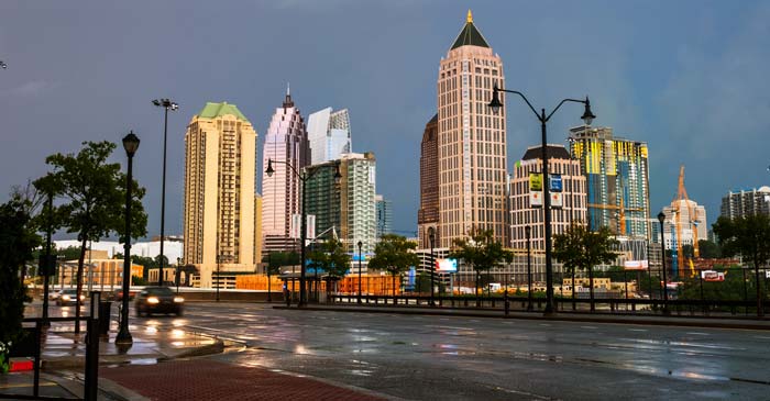
Impervious Surfaces like streets and parking lots cause lot’s of runoff.
Zoning Regulations in Gwinnett, Dekalb, and Fulton Counties
Counties set specific regulations for the maximum lot coverage, or amount of impervious surface, allowable for a given lot. In Gwinett County, this area may not exceed 50% of the total lot size for a detached single-family home. In Dekalb county, that limit is set at 75% for a detached single-family home. Fulton county’s regulations vary from a 25% maximum lot coverage to 85% depending on the acreage of the lot. These regulations help to keep flooding under control and improve the quality of our drinking water.
Massive Rainstorms in Downtown Atlanta
A study completed by the City of Atlanta Department of Planning and Community Development in 2014 concluded that 30% of the city’s land area is considered an impervious area. The majority of those spaces are concentrated in the business districts, industrial areas, and transportation routes.
In the first month of 2020, Downtown Atlanta received nearly 20 inches of rain, with its wettest day nearing 6 inches in total. That is an extreme amount of water considering the monthly average over the last 10 years is 10 inches. This year, more than 40% of the days in January were rainy.
Impervious Surface Coverage in Atlanta, Georgia
In the last 50 years, the city of Atlanta has seen exponential growth. This means more construction, more impervious surfaces, and more stormwater runoff. This particularly affects Peachtree Creek which is a major tributary of the Chattahoochee River.
The U.S. Geological Survey, or USGS, has been monitoring streamflow and stream stage at the Northside Drive gage location on Peachtree Creek since 1958. USGS has consistently reported a steady increase in the frequency and severity of flooding in the Peachtree Creek Watershed at that time.
The Hidden Danger of Stormwater Runoff
Stormwater runoff is rainfall that is not absorbed into the ground. As this water flows across various landscapes, like paved surfaces such as sidewalks and parking lots, it picks up pollutants. These pollutants include things like antifreeze, motor oil, fertilizers, pesticides, bacteria from failing septic systems and pet waste, and a lot more.

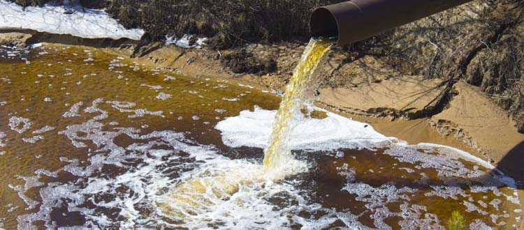
Stormwater Runoff Pollution
This polluted runoff is then collected by storm drains and eventually deposited into our streams and lakes. Many fish and other wildlife suffer from this pollution, and eventually, these poisons enter our public drinking water supplies. Stormwater runoff is also responsible for eroding our local stream banks. This causes sediment buildup that clogs waterways and can kill local fish and wildlife.
Stormwater Management Regulations in Sandy Springs, GA
In an effort to improve water quality, the city of Sandy Springs, located in North Fulton County, has tightened stormwater runoff regulations. The new standards are set to more closely resemble the Atlanta Regional Commission’s updates to its Georgia Stormwater Management Manual. More commonly known as the Blue Book, this required state standard provides tools for municipalities to use for stormwater management.
Actually, the Sandy Springs City Council took it a step further. It is now required that stormwater drainage management begins at 1,000 square feet of impervious surface for residential applicants, down from 5,000 square feet. Commercial projects would trigger these requirements at 500 square feet of impervious surface. Stormwater retention requirements are set at 1.2 inches, up from the previous 1-inch requirement.
Community Involvement for Stormwater Management Practices
In addition to the stringent regulations set in place by the city council in July of 2016, Sandy Springs has developed multiple steps and solutions for the problem of stormwater runoff. A major factor in improving water quality in Sandy Springs is educating the community on the importance of preventing stormwater pollution.

Neighborhood Storm Drain Marking Program Marker
The Neighborhood Storm Drain Marking Program has been instituted in an effort to do just that. Storm Drain markers are small, colorful signs that are affixed by residents to the top of storm drains to help remind people that anything dumped into the storm drains will flow straight into our streams, creeks and rivers.
A Natural Solution for Impervious Surfaces and Stormwater Management
There are two beautiful and functional rain gardens located in Sandy Springs. The Marsh Creek Rain Garden, opened in December of 2016, was designed to filter contaminated stormwater runoff with natural flora in a beautiful parklike setting. More recently, in May of 2019, the City of Sandy Springs celebrated the ribbon-cutting Ceremony for it’s newest rain garden.
The Morgan Falls Overlook Park Rain Garden contains native aquatic vegetation and specifically designed soils intended to clean and treat stormwater runoff. This flora absorbs pollutants while providing food and habitat for butterflies and other pollinators.

The Law Offices of Sam Maguire, Jr., P.C.
For more information on zoning variances contact a trusted legal team like The Law Offices of Sam Maguire Jr. P.C.


